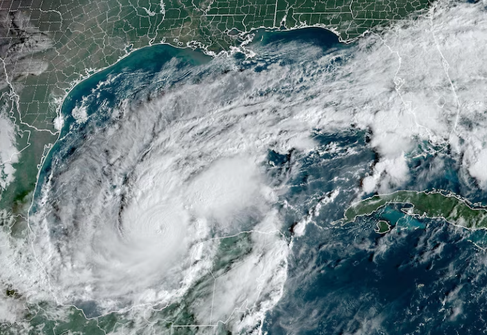
Hurricane Milton barreled towards the Gulf Coast of Florida as a Category 4 hurricane with maximum sustained winds of 145mph, and a barometric pressure reading of 931mb, according to the National Hurricane Center. The storm is currently moving northeast at 17mph.
It was expected to make landfall just south of Tampa on the evening of October 9th as a category 3 storm. A massive storm surge was projected for the area, with peak surges being from 10-15ft. Rainfall was also expected to be at least 1ft in some parts. The storm also produced some tornados on the Floridian Peninsula as well.
Mandatory evacuations have been in place for several counties along the coast and are strongly encouraged in other parts of the state. People who are in mobile homes, RVs, or any other low lying areas were encouraged to move inland.
The hurricane had a peak intensity of 180mph and a barometric pressure of 897mb, making it the fifth most intense hurricane ever recorded in the Atlantic basin.
Hurricane Milton is being regarded as potentially one of the most devastating hurricanes to make landfall in the state of Florida. As for the Tampa Bay region, Milton will be the strongest storm to hit the region in over 100 years. Tampa Bay’s location on the Gulf Coast of Florida means that it is rarely subjected to these types of strong hurricanes. The last major hurricane to make direct landfall in the Tampa Bay Region was the 1921 Tampa Bay Hurricane which made landfall as a category three storm. Since 1921, there have been only a handful of storms that made landfall in the region, so the area around Tampa Bay has been spared when it comes to major hurricanes.


